Switch to:
 EN
EN  Português (PT)
  Español (ES)
How many times have you been surprised before a flight to learn that the weather was not favorable for takeoff to take place safely? Or how many times has a circling holding pattern before landing made your trip last a little longer than usual?
Going through it or not, it’s a fact: weather is one of the most important factors when planning a flight. Long before your departure, even while you are still resting peacefully at your home or working at your office desk, pilots and operational technical dispatchers are together analyzing all available forecasts so that itinerary planning meets the highest safety standards and the minimum operational requirements of each aircraft.
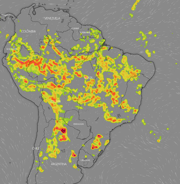
With the advancement of technology and means of consulting aeronautical information over the last few decades, meteorological information has become even more refined, allowing for accurate planning as well as more comfortable and safe flights. Satellite images became available in high definition, in the same way that meteorological maps — the name given to the document that contains all the information used by pilots and dispatchers — began to contain even more information about the advance or retreat of cold and warm fronts, volcanic activity, high-altitude jet streams, clouds potentially harmful to flight, cyclones and tropical storms, and even intense weather activity near the tropics or equator, where the Intertropical Convergence Zone (ITCZ) is located.

Aviation: Made from Accumulated Knowledge

In June 1982, a British Boeing 747 was on a regular route between London, UK, and Auckland, New Zealand. On board were 248 passengers and 15 crew. During the flyby in Malaysian territory, near the city of Kuala Lumpur, the technical crew noticed the emergence of a phenomenon called Saint Elmo’s Fire, an electroluminescent discharge caused by the ionization of air in the vicinity of an area with strong electrical activity. The phenomenon also gained the attention of passengers seated at the front of the aircraft, as it was also noticed on the wings of the huge jumbo jet. Minutes after the appearance of the phenomenon, a strong smell of sulfur began to permeate the passenger cabin, along with an increasingly dense black smoke spurting out through the ventilation ducts of the air conditioning. With the need to use oxygen masks due to the increasing difficulty of natural breathing on board, the temperature set to twenty-one degrees in the Boeing passenger cabin was replaced by intense heat, close to 37 degrees. In this quick succession of events, the plane’s four engines shut down, one after the other, in a very rare event called the “Total Engine Flame-Out”. Immediately, the Boeing 747 became the largest glider in the world. And, with their position and conditions of altitude, speed, weight, and balance at the time of the total shutdown of the engines, it would be possible to fly for only 170 kilometers.
As the aircraft slowly descended, the technical crew followed all the necessary procedures for the engines to be restarted. In the passenger cabin, flight attendants prepared the cabin for an emergency landing. Minutes later, as fast as the events that turned the jumbo into a huge glider, all the plane’s engines started working again in sequence. With that, the crew immediately chose to land in Jakarta, Indonesia. The landing was a success and all occupants of the aircraft were unharmed. The incident then began to be investigated by aviation authorities in the United Kingdom, the place of origin and registration of the aircraft, and included authorities in Malaysia and Indonesia. In a short time, the cause of what could have been a catastrophic accident was found: the aircraft penetrated, without its crew knowing, an area full of volcanic activity. The Galunggung volcano, one of several active volcanoes on Java Island, was responsible for spewing huge amounts of volcanic ash into the atmosphere. Therefore, without any warning of volcanic activity and without any meteorological forecasts that indicated the volcanic danger, the flight proceeded without any detour or alternative route. With all the lessons learned from this 1982 event, all aviation sectors improved their volcanic activity alerts, providing pilots in detail with all the necessary information for the routes to be flown, with operations limited to a generous distance from the epicenter of any volcano’s activity. Therefore, there are currently no recent reports of aircraft involved in incidents or accidents caused by penetration of volcanic ash.
Technology: A Great Ally in Meteorological Analysis
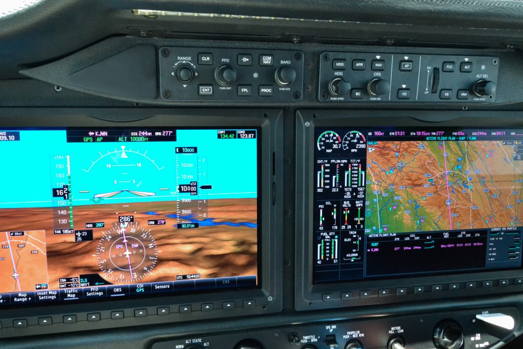
Currently, a major part of the aircraft that comprise executive aviation and the air taxi sector in Brazil are equipped with diverse incremental improvements in technology that, when used in the correct manner, contribute to augmenting safety in flight, while also providing the flight crew with advance forecasts as to what may lay ahead. In this way, all deviations or mitigating measures can be taken well in advance. This occurs from two principal factors: the adoption of the latest technological refinements, such as antennas to detect meteorological phenomenon in the nose or the wing of the aircraft, as well as the adoption of the “glass cockpit” – responsible for making aircraft cabins more modern, digital, and interactive. Through the screens present in the aircraft cabins, the crew can visualize at all times meteorological formations that cause discomfort or are dangerous to the flight. The antennas detect the resplendence of water droplets present in clouds and in the atmosphere itself. These results, after being processed by computers, are displayed in color with instant updating, directly to the pilots. Thus, it became possible to know exactly the ideal pathway for the flight route, in all aspects.

Already in some aircraft, technological advancements are embedded in the cockpits that, very easily, allow for requesting up-to-date meteorological information at any time through satellite communication – not only for the current route, but also for the destination airport, and alternative airports if the original landing site is not practicable for the landing. These updates are displayed in text — in a system similar to instant messaging — sent by an automated system on the ground. In some cases, communication between the aircraft and the ground takes place through a meteorologist, signaling in real time everything necessary for pilots to be able to make the best decisions in a timely manner. With this, even in places where radio communication is unstable, access to information that prevents accidents and air incidents is made possible.
Your Safety Comes First
When the commander of an aircraft, together with another commander or co-pilot of the flight, decides to postpone the take-off or change the landing location during the flight, it is always taken with a view to the safety of passengers, the aircraft, and their own life. All the lessons learned through years of experience, as well as after several improvements made throughout the aeronautical industry, are translated into the refinement of the decisions made by those responsible for the flight.
It is precisely for this reason, due to the commitment to transport you, our customer, within the highest existing safety standards, that Flapper has several partner air taxi companies with an impeccable safety record. In addition, all aircraft used are duly authorized by the National Civil Aviation Agency (ANAC) for air taxis. This guarantees the certainty of supervision, inspection, and submission to the rules imposed by the regulatory body, bringing even more seriousness on the part of the operators’ company, safety processes that involve the flight, aircraft maintenance, and above all, the training of the crew involved in the operation. So, by choosing an Empty Leg available on Flapper’s website or app, or by booking an exclusive flight, dedicated to your needs, you will be able to fly with complete peace of mind, comfort, and the certainty of being well taken care of by all of us. We look forward to seeing you on your next flight!
